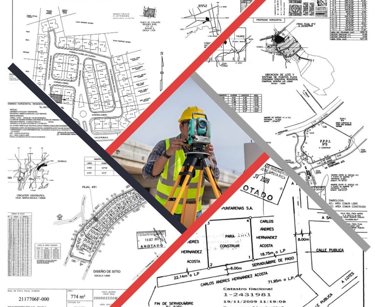
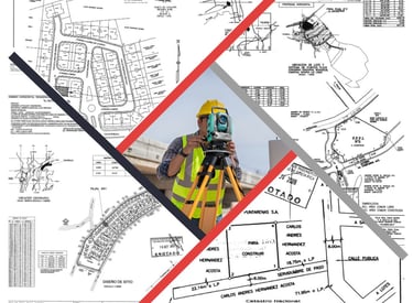
OUR SERVICES
We adapt to your needs, advise you, and provide professional, ethical, and responsible solutions.
Appraisals
We investigate the value of your property according to your needs.
Expert Reports
We thoroughly analyze the property of your interest to clarify your doubts and provide you with solid inputs that allow you to make decisions and/or secure your investment.


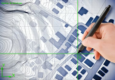
Cadastral Plans
We not only create plans, but we also value your peace of mind and believe in the importance of transparency and communication. Therefore, we advise you and keep you informed before, during, and after the process.
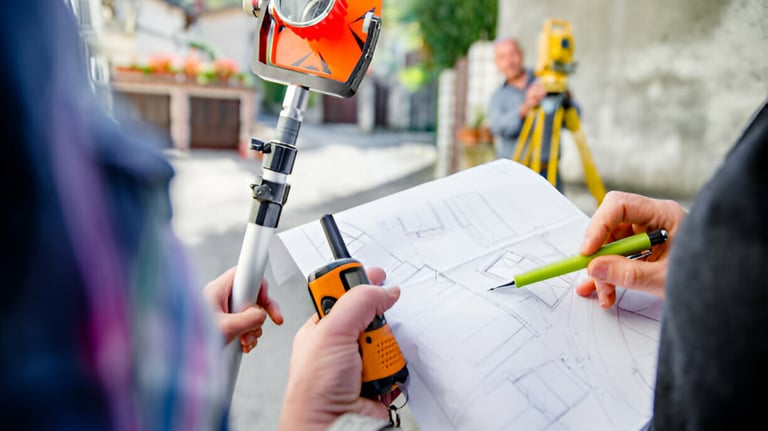
Boundary Localization
We understand the importance of clearly defining the extent of a property, as it is within this boundary that full property rights are exercised. We help you locate these boundaries.
Contour Lines
Gain a clear understanding of the real and three-dimensional shape of your property, allowing you to execute your projects with confidence and without surprises.


Structure Staking
We bring designs from the computer to the field and help make them a reality with accuracy and precision.
Appraisals
What is an appraisal?


An appraisal is defined in many ways, but simply put, it is an assessment of the value of a property. It is a detailed study of the property's characteristics to identify, based on its particular purpose, the amount of money that should be assigned to it.
What types of appraisals are there?
According to international standards, there are three approaches, each with its own methods. Examples of these are:
Cost Approach:
Methods: Replacement Cost Method, Reproduction Cost Method and tax valuation for tax purposes.
Sales Comparison Approach
Métodos: Comparable Transactions Method, Multi-Criteria Decision Analysis (MCDA), Regression Analysis.
Income Approach:
Métodos: Discounted Cash Flow (DCF), Capitalization Method, Residual Method.
How do I know which one I need?
Commonly, the most required are the market and cost approaches.
Market: It is usually used for the sale or purchase of properties. This way, you ensure you have the most probable transaction value of the asset, thus reducing sale times and speculation.
Cost: It is often needed for tax purposes to ensure the correct amount of taxes is paid.
The cost of an appraisal is regulated by the minimum fee schedule of the Colegio Federado de Ingenieros y Arquitectos (Federated College of Engineers and Architects), and it is based on the value of the property and other costs associated with its location. Therefore, there is no single fixed amount.
However, the cost is much lower compared to its benefits, and we are happy to provide you with a quote without obligation.
As for the time, from the visit to the presentation of the report, it usually takes no more than 7 business days, although the time may vary depending on its complexity.
Appraisal as an Investment
An appraisal offers you the peace of mind of knowing if the price you are charging or going to pay is correct, increasing the probability of sale and reducing the transaction time. This results in considerable savings and economic benefits, justifying its initial cost many times over.
What does an appraisal include?
Depending on its purpose, the content may vary, but it usually consists of a technical report that includes the results of the property inspection, market research (if applicable) and its mathematical and statistical processing, environmental analysis, apparent risks and/or findings of significant consideration, cadastral and registry information, as well as observations and recommendations.
In other words, you are presented with a complete status of the property so you can understand more than just its value and make decisions with confidence.
How much does an appraisal cost and how long does it take?
Expert Reports
What is a Topographic Expert Report?
A topographic expert report is a technical document prepared by a land survey engineer. Its objective is to evaluate and analyze a property in detail, studying aspects such as location, situation, area, routes, boundaries, cadastral information, registry information, and any other relevant data according to the purpose of the survey.
Once the investigation and processing of the relevant data are completed, the results are presented in a detailed report that clearly outlines the current situation of the property, enabling informed decision-making.
Why is a Topographic Expert Report Necessary?
A topographic expert report is essential in various situations due to its precision and detail. Some of the main reasons for its preparation include:
1. Resolution of Property Disputes: In cases of boundary disputes or issues between properties, a topographic expert report provides a solid technical basis for conflict resolution.
2. Project Planning and Development: For the design and execution of construction, urbanization, or infrastructure projects, it is essential to know the topographic characteristics of the land. This ensures that the project adequately adapts to the environment and minimizes risks.
3. Buying or Selling Properties: A detailed report helps both the buyer and the seller to be certain about the property’s boundaries, land characteristics, cadastral and registry situation, and prevents or clarifies any legal inconveniences or restrictions that may affect the property’s use in immediate or future transactions.
4. Otros: For any case where certainty is required, or to clarify possible errors in a plan, cadastral map, construction location, setbacks, etc.

How much does an expert report cost and how long does it take?
The cost of an expert report is determined by the complexity of the case, its objectives, as well as the area and location of the property. For this reason, there is no single fixed amount.
Invest in your peace of mind, we are happy to provide you with a quote.
As for the time, from the visit to the presentation of the report, it usually takes no more than 7 business days, although the time may vary depending on its complexity.
What does an expert report include?
Depending on its purpose, the content may vary, but it usually consists of a technical report that includes the results of the property inspection and the information gathered with topographic equipment, as well as cadastral and registry studies, findings report, and it includes observations and recommendations.
As a result, you will have a solid document that will allow you to thoroughly understand the property of your interest as well as the situations or specific elements that have been addressed.
What validity does a topographic expert report have?
Depending on the required purpose, a report prepared by a land survey engineer may be sufficient, as this professional holds public faith according to Law No. 4294 (Article 12) and its Regulation, Decree No. 21 of February 26, 1970 (Article 11), where the quality of the surveyors' notary powers is established. The final paragraph states: "...persons authorized to practice land surveying will have public faith in the exercise of their profession only as surveyors, for which they are solely responsible for the objectivity and accuracy of the graphic and written information that includes the plans and documents they sign, referring to routes, areas, and locations."
If the objective sought encompasses broader issues, it is advisable to conduct an interdisciplinary investigation, according to the specific need.
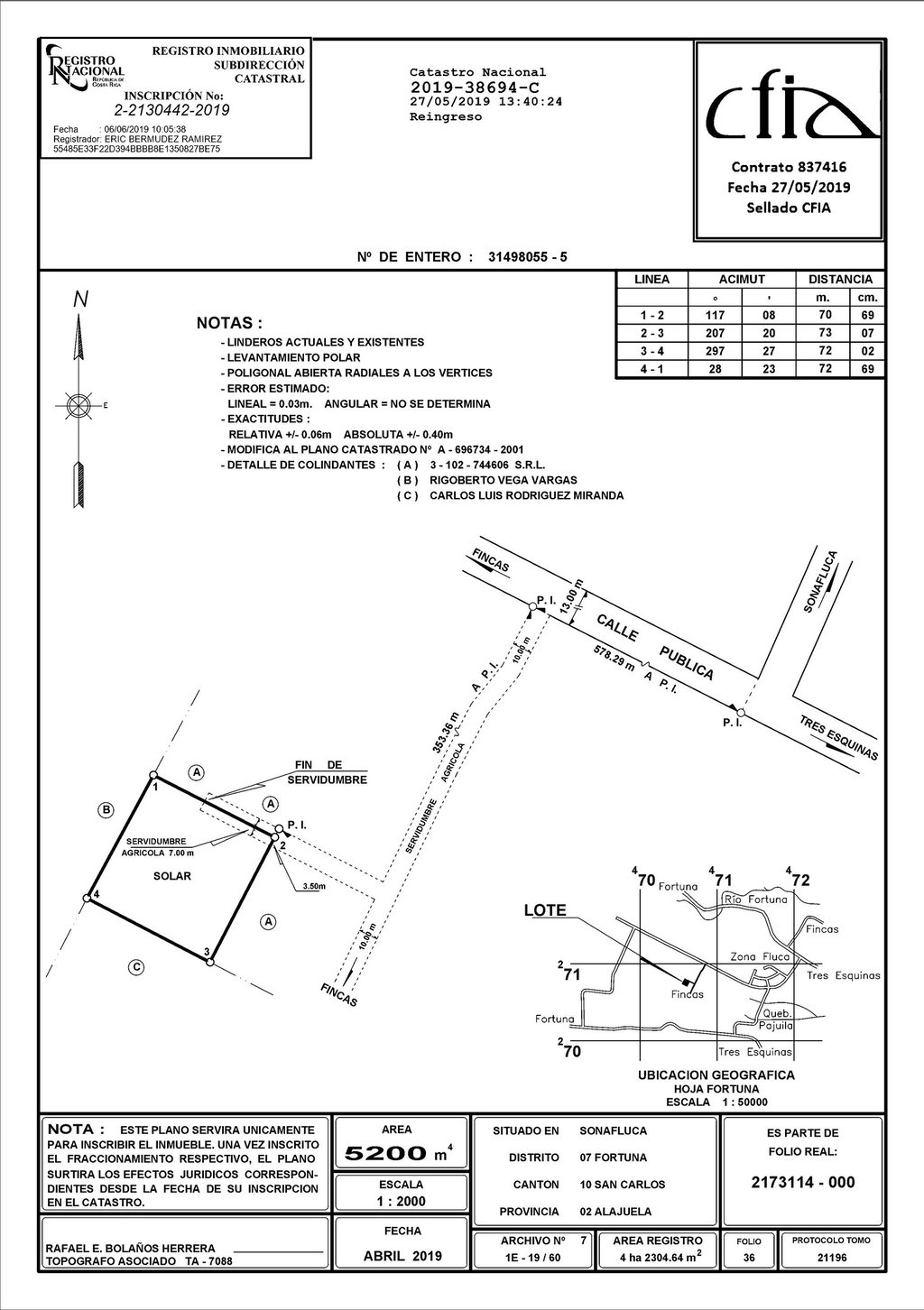
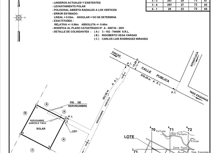
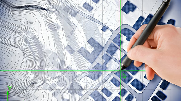
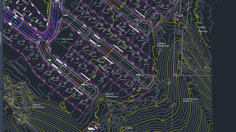
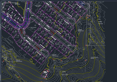
Cadastral Plans
What is a cadastral plan?
A cadastral plan refers to the graphic and technical representation of a property, including its location, dimensions, boundaries, and other relevant details that comply with the regulations of the national cadastral law and have been registered with the national registry.
Why is a cadastral plan important?
This type of plan is essential for registering properties in the Public Registry, as it provides the necessary information to ensure the accuracy of cadastral and registry records. In Costa Rica, cadastral plans are a requirement for the property registration process, as well as for registry transactions such as sales, mortgages, transfers, and others. They are fundamental for establishing the physical and legal characteristics of the land.
When do I need to create a cadastral plan?
Some of the most common situations requiring a cadastral plan include:
Registration of New Properties: When a piece of land that has not been previously registered in the cadastral system needs to be recorded, it is essential to present a cadastral plan showing the property's features and boundaries.
Subdivision of Properties: If an existing property is to be divided into two or more parcels, cadastral plans must be prepared for each new unit, showing how the original land has been divided.
Boundary Modification: If the boundaries of a property change due to the purchase of additional area, sale of part of the land, or corrections of errors in the previous description, the cadastral plans need to be updated to reflect these changes.
Regularization of Properties: For properties without formal documentation or whose boundaries are not clearly defined in previous records, creating a new cadastral plan is crucial to formalize and clarify the cadastral and registry situation.
Urban Developments and Construction Projects:Before starting any development or construction on land, especially in urban areas, a cadastral plan detailing the location and characteristics of the land according to current regulations must be presented.
Legal Processes or Disputes and Mortgages: In situations of legal disputes over boundaries or land ownership, as well as in mortgage processes, an updated cadastral plan is fundamental to clearly establish the facts before judicial, administrative, or banking authorities.
Localization of Rights:When locating the right to a property on the land and wishing to individualize it by creating an independent estate.
These plans must comply with specific regulations that guarantee their accuracy and validity. For example, they must include details such as the coordinates of the property's vertices, exact areas and dimensions, and must be prepared in accordance with the standards established by the National Registry and the Cadastral Directorate. Additionally, they must be georeferenced to ensure that the land's location corresponds with existing cadastral information, which is vital for territorial management and urban and rural planning.
The cost of preparing a cadastral plan is regulated by the minimum fee schedule of the Colegio Federado de Ingenieros y Arquitectos (Federated College of Engineers and Architects) and is primarily determined by the area, location, and complexity of the plan.
For this reason, there is no single, generalized fee, as each case must be assessed based on its particularities.
We understand that behind each plan, there is a significant reason for its creation, which is why we commit to providing expedited, timely, and professional attention and follow-up to your case.
Additionally, we can arrange payment agreements; feel free to consult us without obligation.
As for the time required, from the initial visit to obtaining registration in the national cadastre, it will also depend on each particular case. It can take from 3 to 6 months, a period that may be shorter or longer depending on the complexity, procedures, and bureaucracy involved.
However, we conduct a thorough preliminary analysis before the procedures to provide you with a transparent and clear overview of these times and their reasons. Additionally, we advise you on all aspects that can expedite the processes and keep you informed throughout the entire process.
How much does it cost and how long does it take to prepare a cadastral plan?
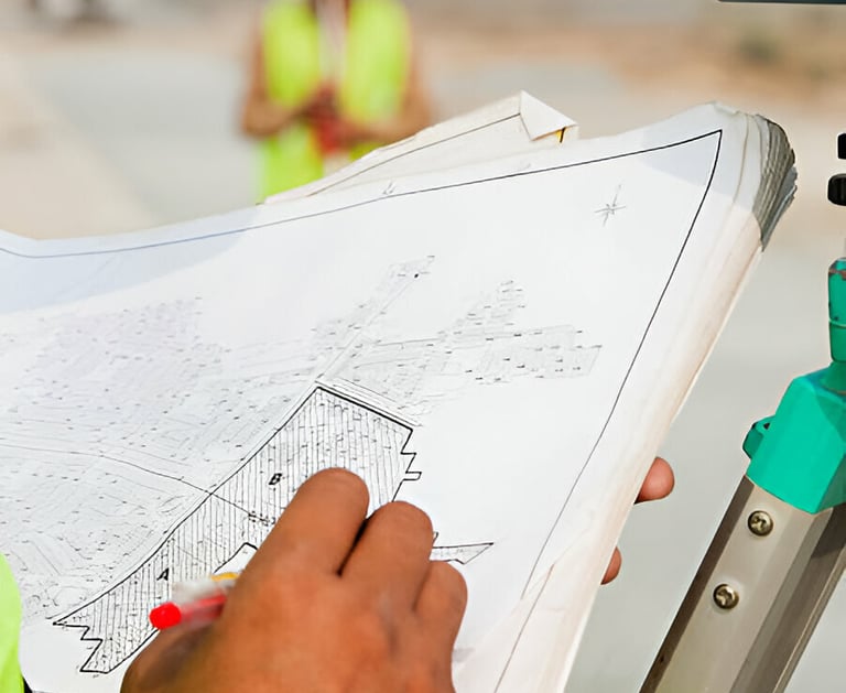
Boundary Location
What is a boundary?
A boundary is the dividing line between two real estate properties. In the specific case of cadastral plans, it is used to describe the limits or edges of a piece of land. Practically, a boundary can be marked by natural and/or artificial elements such as rivers, roads, walls, or fences, or it can simply be lines marked on a plan or a cadastral map indicating the separation between two properties.
What does it mean to locate a boundary?
Locating a boundary is a technical process performed by a land survey engineer. It begins with a detailed study of the cadastral and registry information of a property. This includes reviewing legal documents and maps to understand the dimensions and limits of the land. Using advanced tools like Geographic Information Systems (GIS), the surveyor analyzes and processes geographic data to determine the exact location of the land and the orientation of its boundaries.
Once these boundaries are clearly defined on maps and digital systems, the next step is to transfer this information to the physical land. This is done by "materializing" the boundaries, which means physically marking the vertices of the polygon that defines the property, usually using stakes, rods, or marks on the ground. This process facilitates and guides any permanent demarcations that may be made later.
When do I need to locate the boundaries of my property?
Locating the boundaries of a property is necessary in several key situations involving both legal management and the use and development of the land. Here are some of the most common circumstances where it is crucial to accurately determine these limits:
Buying and selling properties: When purchasing or selling land, it is essential to know exactly the boundaries to ensure that the property's dimensions and limits are clear and correct. This helps to avoid future disputes between adjacent owners.
Construction of structures: Before starting any type of construction, it is necessary to determine the boundaries to ensure that the construction does not encroach on neighboring land. This is particularly important to comply with local planning and construction regulations that set restrictions on how close to the boundaries you can build.
Subdivision of properties: When dividing a property into smaller lots for sale or development, it is imperative to establish the boundaries of each new lot. This ensures that each lot has adequate access and that zoning and planning laws are respected.


Dispute Resolution: When there are conflicts between adjacent property owners regarding the location of the boundaries, it is necessary to locate and verify these boundaries to resolve the disputes legally and avoid prolonged litigation.
Installation or Replacement of Fences or Barriers: To install or replace fences, walls, or any other type of physical barrier, it is necessary to know the exact location of the boundaries to ensure that the installation is done within the authorized property limits.
Refinancing or Mortgages: Banks or financial institutions may require a verification of the boundaries as part of the property assessment process for refinancing or a mortgage.
Real Estate Developments and Improvements:When making significant improvements to the property or developing real estate projects, locating the boundaries helps ensure that all work is performed within the property and in accordance with relevant regulations.
How much does it cost and how long does it take to locate boundaries?
The cost of locating boundaries is regulated by the minimum fee schedule of the Colegio Federado de Ingenieros y Arquitectos (Federated College of Engineers and Architects) and is primarily determined by the area, location, and complexity of the task.
For this reason, there is no single, generalized fee, as each case must be assessed based on its particularities.
We can arrange payment agreements; feel free to consult us without obligation.
As for the time required to locate boundaries, it usually takes no more than seven business days from the contract date to the delivery of the report. However, the time may be shorter or longer depending on the complexity and size of each property.
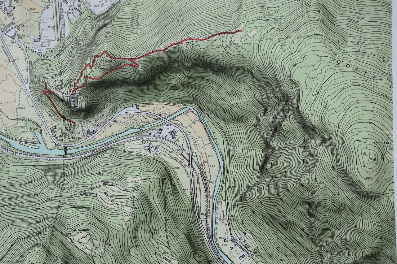
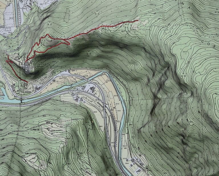
Contour Lines
¿Que son las curvas de nivel?
Las curvas de nivel son líneas trazadas en un mapa o un plano, que representan puntos de igual altitud sobre el nivel del mar, permitiendo visualizar el relieve de un área geográfica. Cada línea de una curva de nivel conecta puntos que tienen la misma altura, y la distancia entre estas líneas indica la inclinación del terreno: un espacio estrecho entre líneas sugiere una pendiente pronunciada, mientras que un espacio más amplio indica un terreno más llano. Estas curvas son herramientas esenciales en la planificación de obras, así como en la planificación territorial, ya que proporcionan una representación clara y comprensible de la topografía de un lugar sin necesidad de verlo físicamente.
¿Cuando se necesita conocer las curvas de nivel de un terreno?
Los motivos más comunes en los que se necesita conocer las curvas de nivel de un terreno son los siguientes:
Planificación y Diseño de Construcciones: Las curvas de nivel son fundamentales para diseñar los cimientos de edificios, carreteras, puentes y otras estructuras, adaptándolos adecuadamente a la topografía del terreno.
Agricultura y Gestión de Recursos Hídricos: Ayudan a determinar las mejores prácticas para el uso y conservación del suelo y el agua, incluyendo el drenaje, la irrigación y la prevención de la erosión.
Análisis Ambiental: Se utilizan para evaluar impactos ambientales y planificar la conservación de hábitats naturales, control de inundaciones y manejo de cuencas hidrográficas.
Urbanismo y Planificación Territorial: Facilitan la planificación de la expansión urbana, la zonificación y el desarrollo de infraestructuras como sistemas de transporte y servicios públicos.
Navegación y Recreación: En actividades al aire libre como el senderismo o el ciclismo de montaña, las curvas de nivel proporcionan información valiosa sobre la dificultad del terreno.
Development of Urbanizations and Condominiums It is a requirement by urban planning authorities for the planning and design of new residential developments, ensuring that structures and services integrate harmoniously with the terrain and to protect the environment as well as to avoid construction in risk areas.
Obtaining Permits for River Alignments Necessary for the planning and regulation of developments near rivers and other bodies of water, ensuring proper flood risk management and conservation of the natural landscape.
How much does it cost to create contour lines for a property?
The cost of creating contour lines is regulated by the minimum fee schedule of the Colegio Federado de Ingenieros y Arquitectos (Federated College of Engineers and Architects) and is primarily determined by the area, the ruggedness of the terrain, its location, and the density required for the contours.
For this reason, there is no single, generalized fee, as each case must be assessed based on its particularities.
We can arrange payment agreements; feel free to consult us without obligation.
As for the time required to create contour lines, this will also depend on the aforementioned particular factors.
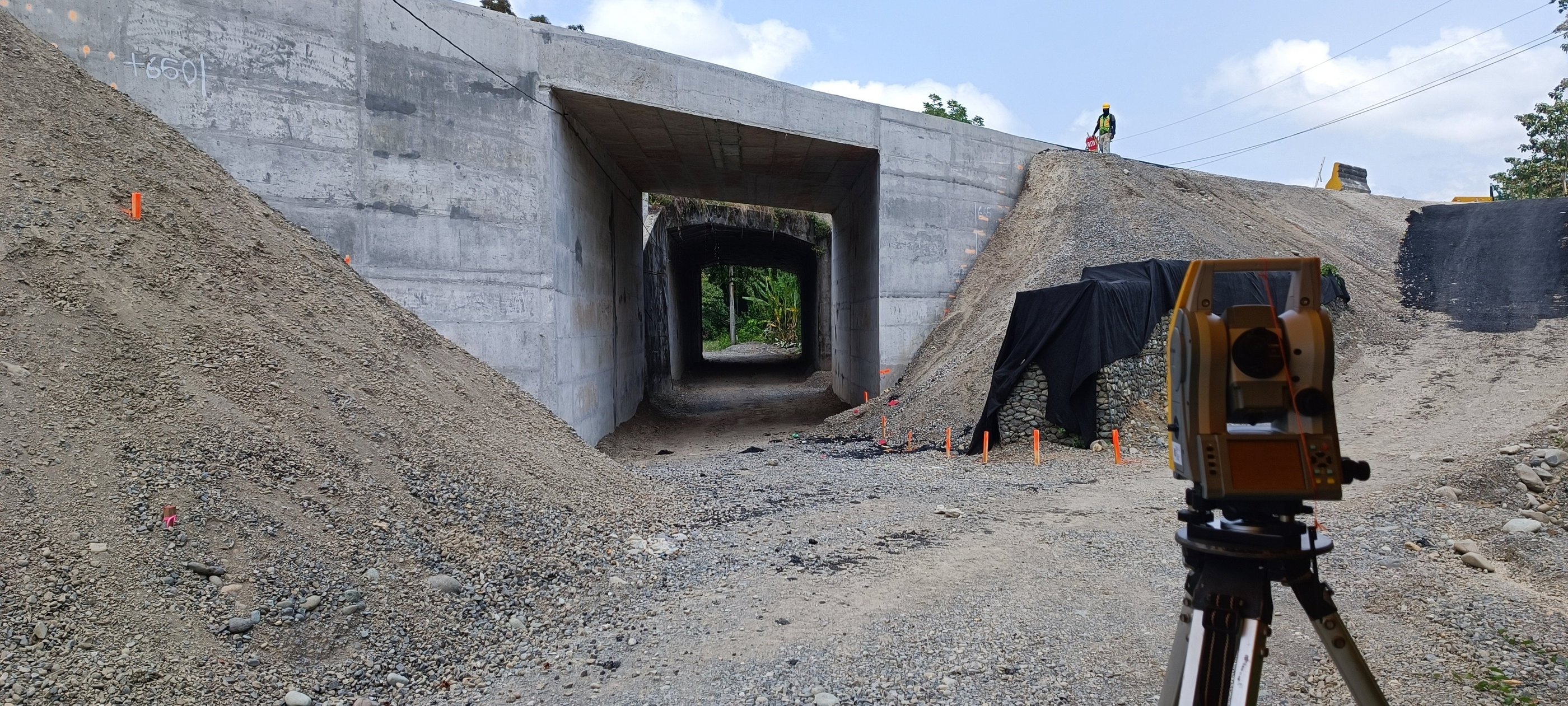
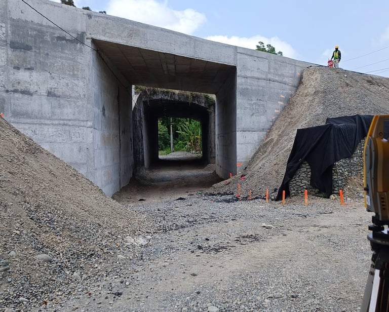
Structure Stakeout
What is structure stakeout?
Structure stakeout is an essential technical process in civil construction and engineering, used to transfer the precise dimensions and locations of a projected structure or infrastructure from the plans and technical documents to the physical ground where it will be built. This procedure ensures that what has been designed in the plans is constructed in the correct location and with the exact dimensions on the actual construction site.
When is it necessary to perform a structure stakeout?
Structure stakeout is required at various phases and situations within a construction project. Here are some of the most common moments and circumstances when a stakeout is necessary:
Start of Construction: Before beginning any work, it is crucial to perform a stakeout to ensure that the construction is carried out in the correct location and according to the design specifications. This includes the location of foundations, walls, columns, and other structural elements.
Before Foundation Work: It is especially important to perform the stakeout before excavating and constructing the foundations or bases of the structure, as an error at this stage can have critical consequences for the safety and viability of the entire project.
Installation of Infrastructure and Services: During the installation of underground systems such as drainage, pipes, and wiring, the stakeout helps to correctly place these components according to the engineering plan.
Expansions or Modifications: If an existing structure is being expanded or modified, the stakeout is necessary to integrate the new construction precisely with the old part, respecting boundaries, alignments, and design requirements.
Construction of Roads and Access Ways: In civil engineering projects such as roads, bridges, and tunnels, the stakeout is fundamental to determine the correct layout and geometric characteristics of the work.
After Design Changes: Any changes to the plans during construction must be followed by a stakeout to update and verify the location of the structures according to the new designs.
Control During Construction: Throughout the construction, it is common practice to perform periodic stakeouts as part of quality control to ensure that the construction is being carried out according to the plans and technical specifications.
Final Verifications: Before the final delivery of the project, a stakeout is performed to verify that all constructions have been completed as projected and to resolve any discrepancies before completion..
Structure stakeout is a critical step that ensures accuracy and compliance with technical specifications at every stage of a construction project, thus contributing to the safety, functionality, and sustainability of the finished structure.